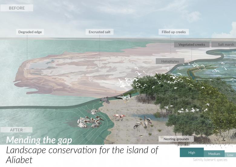
Mending the gap: Landscape conservation for the island of Aliabet
Torna alla Lista di ProgettiCoastal management is one of the most important parameters to be considered in urban planning for a resilient future. In today’s time especially when we are on the brink of climate change, it becomes mandatory to look at the existing ecosystem services and their impact in a larger spectrum.
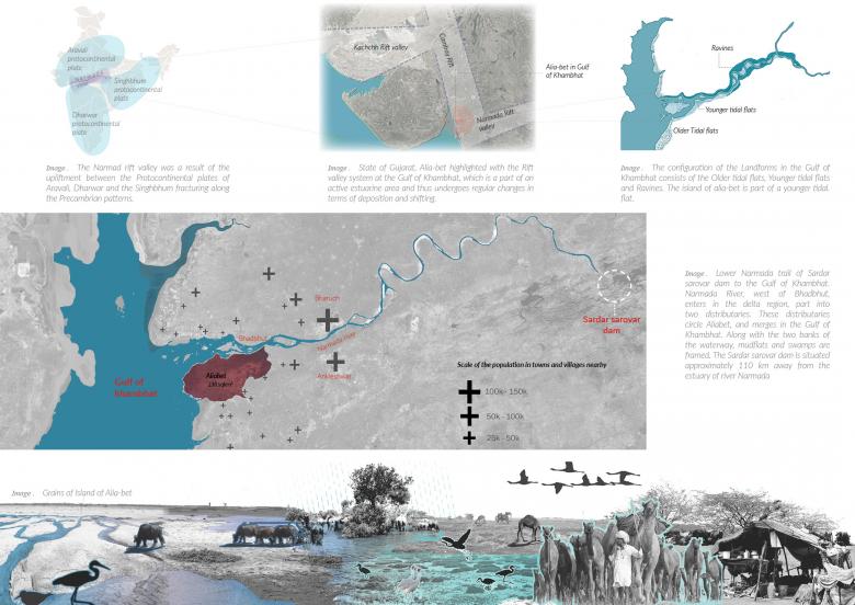
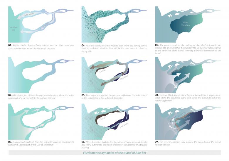
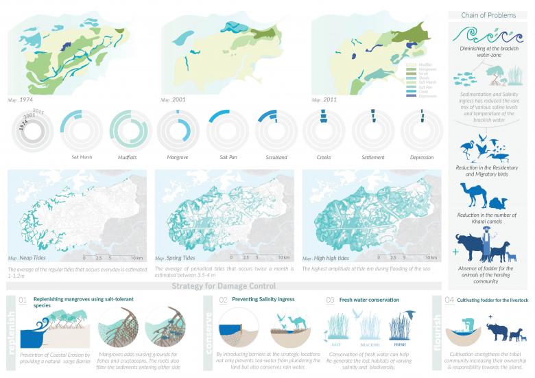
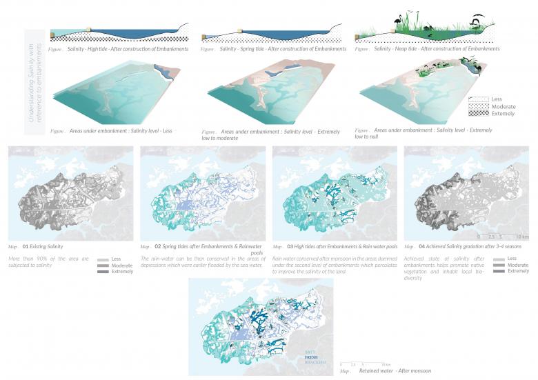
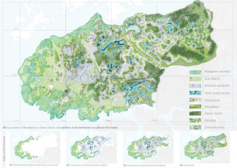
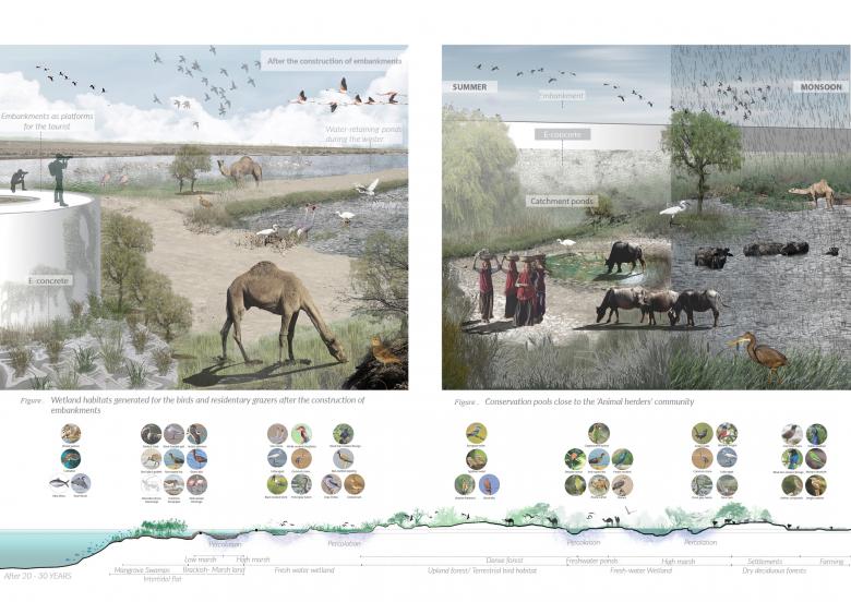
The island of Aliabet is a part of the river Narmada’s estuary which has formed connections with the mainland due to the depositions afflicted by anthropogenic activities like the construction of the Sardar Sarovar dam. Once an ecologically rich and diverse chunk of land, Aliabet was home to many wetland birds and animals. The present conditions and disturbances have replaced the existing physical conditions and habitats that have affected biodiversity in many ways. The imposed man-made conditions have left Aliabet to become a desert and a saline wasteland. This research study is an attempt to understand the drivers and services of the ecosystem of Aliabet in order to revive and strengthen its resources thereby regaining its position in the larger ecological chain.