


Peripheral Cartographies
Back to Projects listProject Location
Inisbofin, Ireland
Topic
Users Identity
Program
Mixed use - Cultural & Social Aggregation, Archives
Countermapping the Irish Island of Inisbofin
Situated on Inisbofin (or Inis Bó Finne), this project proposes and defines alternate types of maps and ways of practising cartography. The project is formulated around an institution which facilitates a postcolonial re-inscription of the island through a countermapping which is deeply entangled with the cartographies of Tim Robinson.
During Britain’s conquest of Ireland, there was a willful ‘othering’ of the people and landscape. A totalizing outlook of Ireland and its people was adopted which depicted an entire diverse entity as savage and disordered - needing to be civilised through division and containment. Further, place names in Irish were stripped of their highly descriptive nature - rendered meaningless by Anglicisation. The landscape was depicted as homogenous and bland by the 1830 Ordnance Survey, adding to this erosion of culture and identity. This project firmly rejects these narratives and embraces the peculiarities and wildness attempting to re-install the diversities of these rich landscapes on Inisbofin.
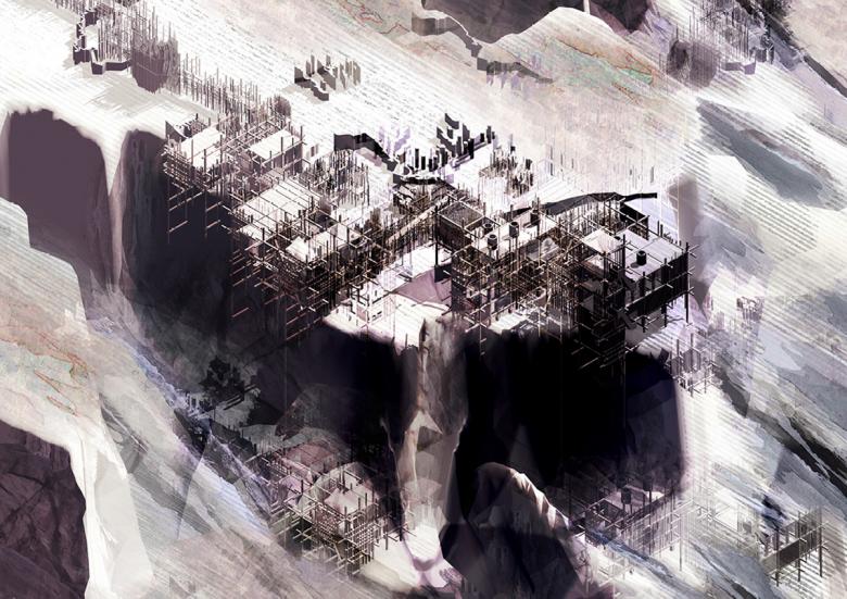
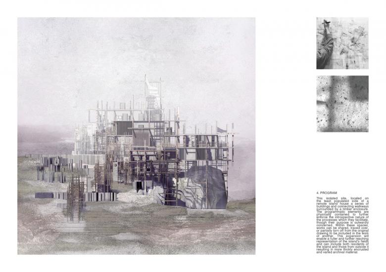
The Archive of Displaced Oneiric Cartographies sits within a constructed indented landscape at Doonmore on Inisbofin. This wake landscape extends beyond the surrounds of the built structures, and fragments derived from marks in the drawings are scattered throughout the site. The architectural conceiving of the project is rooted in intense feelings of immersion within a history which is remembered with immediacy experienced while visiting the island. The generative drawing methodology which is at the core of the project was a catalyst for the design process. These expressions originate from the drawings, and are then reinscribed within further drawings. The graphical qualities of the drawings became entangled with the formalised landscape - one infuses the other, there is no separation between the fields of each. The drawings supplant the landscape and a generative building process is enacted on paper. The main considerations are a distinct interest in chronicling the descriptive and revealing traces and fragments which illustrate the nature of the island’s condition. Inisbofin has a rich social and historical context, which is monumentalized through the embodiment of these fields. The project comprises a series of precariously situated sectional laminations arrayed along the cliff edge. Cantilevered over the precipice, they face a constant battle against degrading ground conditions - a strategy devised to mirror the sense of uncertainty in the work. The siting also serves as a manifestation of the indeterminacy of the island's future. Elements spill over the cliff edge to underscore the urgency of preserving the fragile coastal environments of islands. Each of the distinct programmatic functions within the system of buildings has been determined by the demands of the drawing production process. They have been devised to house an expansion of the individual smaller scale countermapping conducted within the project at the larger scale of an institute. Each element found its origin in a key action within the drawing process, which is paired with a theoretical idea from the research.